These colorful stickers are helping blind people find their way around
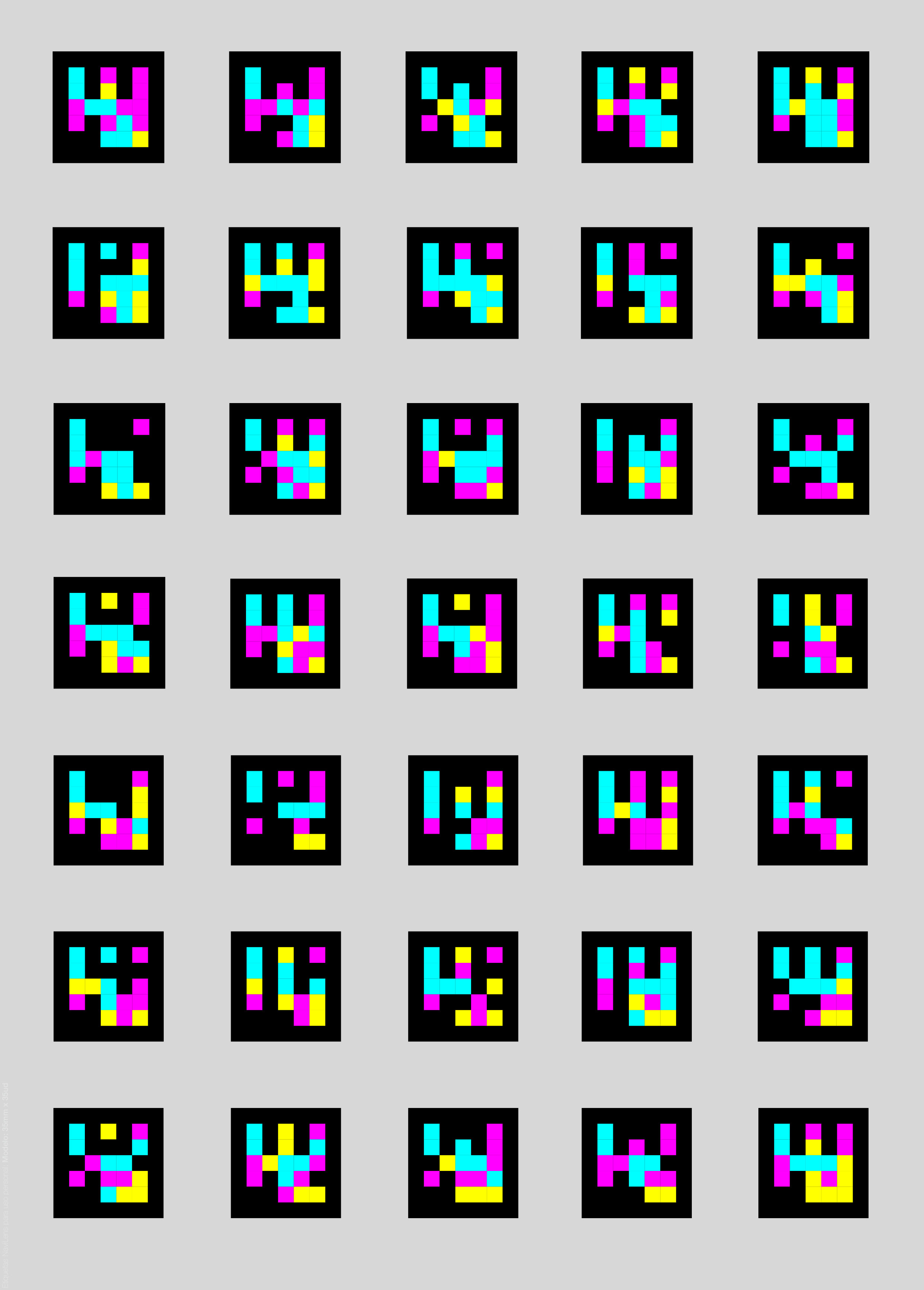
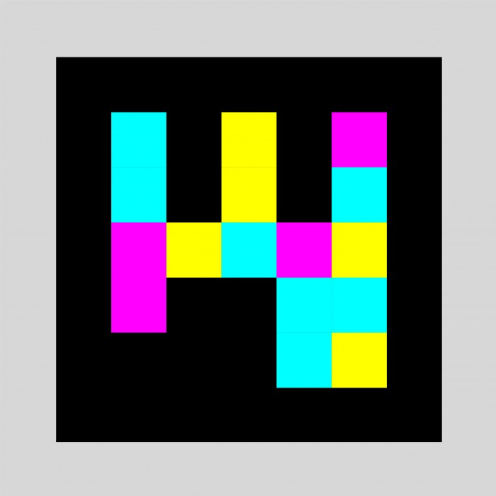
Over the last few months, strange pixelated stickers have been spreading across Barcelona’s transit system. Each is a 5x5 stack of brightly colored squares on a black card, like a disintegrated Space Invader.
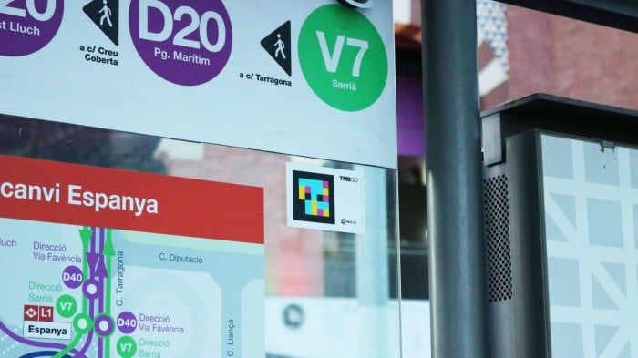
Across the city’s network of buses, trains, trams, and a funicular that clambers up the steep hillside of Montjuïc, the tags are stuck near exits, platforms, escalators, ticket booths, intercoms, and passageways.
This is not the work of some aspiring robot graffiti artist, however, but a program by Transports Metropolitans de Barcelona (TMB), the public transport service, to make the city easier to access and navigate for its thousands of visually impaired citizens.
The system has been developed by the Mobile Vision Research Lab at the University of Alicante, in partnership with Spanish startup NaviLens. Using a smartphone camera and a free app, visually impaired people can scan the codes and hear what information is stored within them.
This can be anything from public-transport timetables to obstacles they should be aware of, or physical descriptions of the surrounding environment. Users can also download plain tags and customize them to add to anything they like, perhaps to label food boxes or personal documents, for example.
This isn’t a new idea: the much-maligned QR code has been around since 1994. But to make its system work, NaviLens had to redesign the bidirectional code from scratch. A 5-inch-wide NaviLens card can be read by a phone from 12 meters (39 feet) away, in a 30th of a second—the time it takes a smartphone camera to grab a single frame.
The phone doesn’t need to focus and can scan tags at up to a 160-degree angle even while in motion. The accompanying app can register over 200 tags in a single frame. “It really seems like magic when you read a label several meters away,” says Barcelona resident Juan Nuñez, who is visually impaired. “Until now there was no alternative but to learn the layout of the stations by memorizing the routes to follow.”
As users sweep their environment with a smartphone, audio cues allow them to find and center the tag in the phone’s field of view. A shake of the wrist prompts the details contained within the tag to be read out (visually impaired people are often holding a guide dog or cane with their other hand).
The information can vary depending on where the user is standing in relation to the tag, and can be programmed in multiple languages, with the phone automatically selecting its native language—important for a city that receives almost 10 million visitors every year. After a successful pilot along a single subway line and bus route, the NaviLens system is being expanded to all 159 Metro stations and 2,400 bus stops, totaling tens of thousands of tags that will form an augmented-reality infrastructure. NaviLens is hoping to expand into other European cities soon.
Neosistec, the parent company of NaviLens, has also developed a separate app for sighted people that uses the tags to generate augmented-reality signposts pointing users to their destination.
The firm joins a crowded marketplace for navigation apps aimed at the visually impaired: Be My Eyes, BlindSquare, DigitEyes, and Moovit, to name a few. NaviLens stands out from the rest because these others mostly use GPS, and Bluetooth beacons have to be installed indoors, says Raül Casas of TMB’s universal accessibility technical office.
Other blind and visually impaired users beyond Barcelona have also been impressed. Marc Powell, a blind judo player who competed in the 2012 Paralympic Games, helps head up the innovation department of the UK’s Royal National Institute for Blind People, which has also been trialing the system.
“We’ve found there’s a bit of skepticism at first,” he says, “but it soon turns into a bit of a giggle, and a wow moment of surprise—did I really just detect something 15 meters away? Knowing what’s around: a quiet room, a vending machine, all of those things bring the building back to life.”
Keep Reading
Most Popular
Large language models can do jaw-dropping things. But nobody knows exactly why.
And that's a problem. Figuring it out is one of the biggest scientific puzzles of our time and a crucial step towards controlling more powerful future models.
The problem with plug-in hybrids? Their drivers.
Plug-in hybrids are often sold as a transition to EVs, but new data from Europe shows we’re still underestimating the emissions they produce.
Google DeepMind’s new generative model makes Super Mario–like games from scratch
Genie learns how to control games by watching hours and hours of video. It could help train next-gen robots too.
How scientists traced a mysterious covid case back to six toilets
When wastewater surveillance turns into a hunt for a single infected individual, the ethics get tricky.
Stay connected
Get the latest updates from
MIT Technology Review
Discover special offers, top stories, upcoming events, and more.